صدر حديثًا
هذا الكتاب جديد وسيتم رفعه فور توفره لدينا وبعد الحصول على حقوق النشر اللازمة.

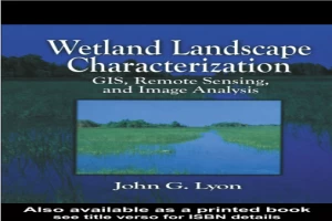
كتاب Wetland Landscape Characterization GIS Remote Sensing and Image Analysis PDF
(0)
المؤلف:
كاتب غير محددعدد القراءات:
176
اللغة:
الإنجليزية
الفئة:
جغرافيةالقسم:
الصفحات:
144
الجودة:
جيد
المشاهدات:
1254
اقتباس
مراجعة
حفظ
مشاركة
جديد
وصف الكتاب
This book was written to assist scientists, engineers, technicians and other resource managers in the evaluation of wetland boundaries and characteristics. Powerful tools - GIS, mapping, remote sensing - are described and demonstrated using practical applications and combined to yield landscape ecological data, and ecological risk assessments. Using numerous technical methods, Wetland Landscape Characterization shows you how to evaluate the presence of wetlands, and the stressors, exposures and ecological systems - streams, lakes, terrestial - that influence their condition. A vital component of the book is the variety of quality assurance/quality control and accuracy assessment techniques presented throughout the text. A thorough understanding of these methods is critical to the success of your project.
JOHN G.LYON
الكتاب غير متاح حاليًا
هذا الكتاب غير متاح حاليًا للنشر. لقد حصلنا عليه من بموجب ترخيص المشاع الإبداعي، ولكن المؤلف أو دار النشر لم يمنحا الإذن بنشره.
قيم الآن
5 نجوم
4 نجوم
3 نجوم
2 نجوم
1 نجوم
اقتباسات Wetland Landscape Characterization GIS Remote Sensing and Image Analysis
الأعلى تقييماً
الأحدث
اقتباس
كن أول من يترك اقتباسًا واكسب 10 نقاط
بدلاً من 3
التعليقات
كن أول من يترك تعليقًا واكسب 5 نقاط
بدلاً من 3