صدر حديثًا
هذا الكتاب جديد وسيتم رفعه فور توفره لدينا وبعد الحصول على حقوق النشر اللازمة.

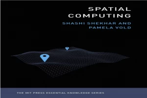
كتاب Spatial Computing PDF
(0)
المؤلف:
شاشي شيخارعدد القراءات:
232
اللغة:
الإنجليزية
الفئة:
مجالاتالقسم:
الصفحات:
257
الجودة:
جيد
المشاهدات:
1734
اقتباس
مراجعة
حفظ
مشاركة
جديد
وصف الكتاب
An accessible guide to the ideas and technologies underlying such applications as GPS, Google Maps, Pokémon Go, ride-sharing, driverless cars, and drone surveillance.
Billions of people around the globe use various applications of spatial computing daily―by using a ride-sharing app, GPS, the e911 system, social media check-ins, even Pokémon Go. Scientists and researchers use spatial computing to track diseases, map the bottom of the oceans, chart the behavior of endangered species, and create election maps in real time. Drones and driverless cars use a variety of spatial computing technologies. Spatial computing works by understanding the physical world, knowing and communicating our relation to places in that world, and navigating through those places. It has changed our lives and infrastructures profoundly, marking a significant shift in how we make our way in the world. This volume in the MIT Essential Knowledge series explains the technologies and ideas behind spatial computing.
The book offers accessible descriptions of GPS and location-based services, including the use of Wi-Fi, Bluetooth, and RFID for position determination out of satellite range; remote sensing, which uses satellite and aerial platforms to monitor such varied phenomena as global food production, the effects of climate change, and subsurface natural resources on other planets; geographic information systems (GIS), which store, analyze, and visualize spatial data; spatial databases, which store multiple forms of spatial data; and spatial statistics and spatial data science, used to analyze location-related data.natural resources on other planets; geographic information systems (GIS), which store, analyze, and visualize spatial data; spatial databases, which store multiple forms
شاشي شيخار
أستاذ ، أستاذ متميز في جامعة ماكنايت ، أستاذ جامعي متميز ، قسم علوم وهندسة الكمبيوتر
اقرأ المزيد
الكتاب غير متاح حاليًا
هذا الكتاب غير متاح حاليًا للنشر. لقد حصلنا عليه من بموجب ترخيص المشاع الإبداعي، ولكن المؤلف أو دار النشر لم يمنحا الإذن بنشره.
قيم الآن
5 نجوم
4 نجوم
3 نجوم
2 نجوم
1 نجوم
اقتباسات Spatial Computing
الأعلى تقييماً
الأحدث
اقتباس
كن أول من يترك اقتباسًا واكسب 10 نقاط
بدلاً من 3
التعليقات
كن أول من يترك تعليقًا واكسب 5 نقاط
بدلاً من 3