صدر حديثًا
هذا الكتاب جديد وسيتم رفعه فور توفره لدينا وبعد الحصول على حقوق النشر اللازمة.

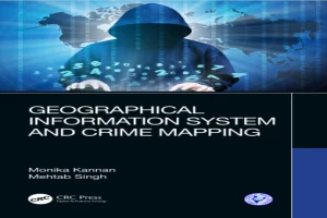
كتاب Geographical Information System and Crime Mapping PDF
(0)
المؤلف:
مهتاب سينغعدد القراءات:
214
اللغة:
الإنجليزية
الفئة:
جغرافيةالقسم:
الصفحات:
50
الجودة:
ممتاز
المشاهدات:
1526
اقتباس
مراجعة
حفظ
مشاركة
وصف الكتاب
Geographical Information System and Crime Mapping features a diverse array of Geographic Information System (GIS) applications in crime analysis, from general issues such as GIS as a communication process, interjurisdictional mapping and data sharing to specific applications in tracking serial killers and predicting violence-prone zones. It supports readers in developing and implementing crime mapping techniques. The distribution of crime is explained with reference to theories of human ecology, transport network, built environment, housing markets, and forms of urban management, including policing. Concepts are supported with relevant case studies and real-time crime data to illustrate concepts and applications of crime mapping. Aimed at senior undergraduate, graduate students, professionals in GIS, Crime Analysis, Spatial Analysis, Ergonomics and human factors, this book: Provides an update of GIS applications for crime mapping studies; Highlights growing potential of GIS for crime mapping, monitoring, and reduction through developing and implementing crime mapping techniques; Covers Operational Research, Spatial Regression model, Point Analysis and so forth; Builds models helpful in police patrolling, surveillance and crime mapping from a technology perspective; Includes a dedicated section on case studies including exercises and data samples.
مهتاب سينغ
الكتاب غير متاح حاليًا
هذا الكتاب غير متاح حاليًا للنشر. لقد حصلنا عليه من بموجب ترخيص المشاع الإبداعي، ولكن المؤلف أو دار النشر لم يمنحا الإذن بنشره.
قيم الآن
5 نجوم
4 نجوم
3 نجوم
2 نجوم
1 نجوم
اقتباسات Geographical Information System and Crime Mapping
الأعلى تقييماً
الأحدث
اقتباس
كن أول من يترك اقتباسًا واكسب 10 نقاط
بدلاً من 3
التعليقات
كن أول من يترك تعليقًا واكسب 5 نقاط
بدلاً من 3